
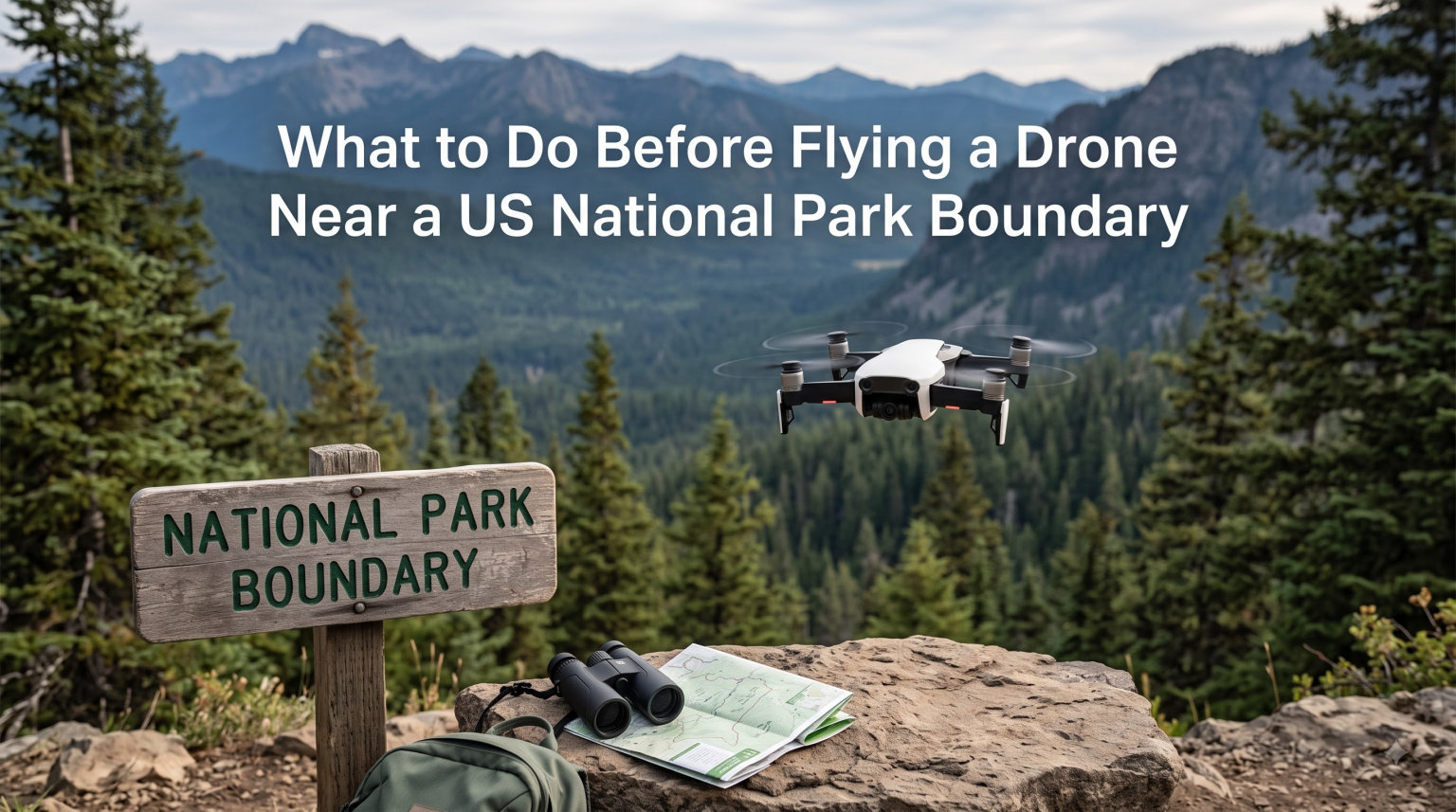
Last summer I pulled into a roadside pull-off near the south rim of Grand Canyon with a DJI Mini packed and ready to fly. The view was perfect. But before I even powered on the controller, I had to answer one loaded question: was my launch spot technically inside the park boundary, or just outside it? That single decision determines whether flying a drone near a national park boundary is a perfect shot or a $5,000 mistake.
I have spent the last three summers traveling the American West with a drone in my bag, and I have learned the hard way that the line between legal and illegal is not always painted on the road. This guide exists so you do not repeat my early mistakes. I will walk you through what the National Park Service actually prohibits, what the FAA still requires, which apps you should open before takeoff, and exactly where you can fly without ending up in a ranger’s incident report.
By the end of this article, you will know how to verify your launch point, what permits exist if you genuinely need to fly inside a park, and how to find legal airspace near the most popular parks. I will also address the question that has flooded Reddit forums for years: can you really fly a drone over a national park from outside the boundary? The answer is surprising, and the reasoning behind it matters even more than the rule itself.
Table of Contents
Why National Parks Ban Drones in the First Place
The National Park Service banned drones in 2014 because the agency saw what was happening on the ground. Visitors were losing the quiet they traveled hundreds of miles to find. Wildlife was being chased off nesting cliffs. Search-and-rescue teams were being grounded by hobbyists who did not know a helicopter was incoming.
I have watched a single drone clear a meadow of mule deer in Yellowstone. The herd bolted before the aircraft was even 50 feet away. That scene is exactly what Policy Memorandum 14-05 was designed to prevent. The ban is not arbitrary; it is a response to documented harm.
Noise Pollution and Visitor Experience
Parks are among the last quiet places in the United States. The acoustic environment at places like Yellowstone and Glacier is measured and protected. A drone at 200 feet registers at roughly 60 decibels at ground level, which is loud enough to interrupt a conversation and stress nesting birds.
Visitors travel to hear wolves howl, rivers run, and wind move through pines. A buzzing quadcopter ruins that experience for everyone in earshot. The NPS heard thousands of complaints during the years leading up to the 2014 ban, and the policy formalized what most visitors already wanted.
Wildlife Stress and Harassment
Wildlife biologists have documented how drones affect animals. California condors, bighorn sheep, and nesting raptors have all been driven from critical habitat by hovering aircraft. Stress hormones, abandoned nests, and disrupted feeding patterns are real consequences that show up in the research literature.
The US Forest Service recommends keeping drones at least 100 meters (328 feet) away from wildlife and never flying directly over animals. I have tried that buffer myself, and I can tell you that 100 meters is a real distance, not the 30 feet many pilots assume. If your drone is close enough to see detailed feathers, it is too close.
Real Incidents That Changed Policy
Two incidents pushed the NPS over the edge. A drone crashed into a Yellowstone geyser in 2014, damaging the delicate mineral formations. The same year, a drone struck Mount Rushmore, prompting a conversation about safety and respect that has never really stopped.
More recently, a February incident at Zion National Park involving bighorn sheep harassment made national news. The park responded by tightening enforcement rather than easing the ban. These events matter because they shape how rangers interpret the policy today, and they are why even legally ambiguous flights can end in a citation.
Understanding Policy Memorandum 14-05
Policy Memorandum 14-05 is the official document that bans drones from US National Parks. It was issued on June 19, 2014, and it directs park superintendents to prohibit launching, landing, and operating unmanned aircraft from park lands.
The policy is short, but every word has been tested in court. Understanding it line by line is the difference between a confident flight and a six-month headache.
What the Policy Actually Says
The memorandum defines three prohibited actions inside any unit of the National Park System. First, you cannot launch an unmanned aircraft from a park. Second, you cannot land an unmanned aircraft in a park. Third, you cannot operate an unmanned aircraft from inside a park, even if the aircraft itself never enters the airspace.
That third clause is the part most pilots miss. Dropping your drone from a cliff edge inside the park to photograph a canyon below is just as illegal as launching from a parking lot. The location of the operator matters, not just the location of the aircraft.
Launching, Landing, and Operating Defined
Launching means any release of the aircraft into the air, including hand launches and gimbal starts. Landing means any touchdown, including catching the aircraft by hand. Operating means controlling the aircraft in any way, including via tablet or goggles, while standing on park soil.
The NPS takes a broad view of these terms. Pilots who think they have found a clever loophole usually discover that the policy closes it. The only real flexibility is geographic, and that is exactly what makes the boundary question so important.
36 CFR 1.5 and the Legal Basis
The policy is enforced under 36 CFR 1.5, which allows superintendents to close areas to specific activities. Violations are typically charged as a misdemeanor under 36 CFR 1.3, which carries the penalties most pilots fear.
Because the regulation is federal, the case will be heard in federal magistrate court, not a county courthouse. That means the fine is paid to the federal government, and the conviction stays on a federal record. This is one of the reasons the consequences feel so serious.
The Boundary Question: Flying From Just Outside the Park
Flying a drone over a national park from outside the boundary is generally legal under current NPS rules, but only if you launch from land that the National Park Service does not administer. The policy prohibits launching, landing, and operating from inside the park, not the act of overflight itself.
That single sentence is the most important thing in this entire article. Most pilots read it, nod, and then immediately ask the obvious follow-up: how do I prove I was outside the boundary when a ranger drives up?
What the Rule Actually Prohibits
If your feet are on NPS-administered land when you press takeoff, you have violated the policy. The drone’s position over the park is irrelevant. The same applies if you land the aircraft on park soil, even briefly, including emergency landings.
The seemingly simple rule gets complicated fast. Many parks have inholdings, easements, and adjacent private property that create confusing edges. The boundary is not always where the sign is. The official park map at nps.gov is the authoritative source, and I check it before every flight near a park.
Overflight vs. Operation
The FAA controls the airspace. The NPS controls the ground. These are two separate jurisdictions, and that is why overflight from outside is technically permitted. The FAA does not recognize NPS boundaries; the agency recognizes airspace classes and temporary flight restrictions.
The practical effect is that you can launch from BLM land next to a park, fly your drone over the park, and never violate NPS rules. As long as you neither launch nor land on park soil, you are operating under FAA rules alone. This is the legal structure that has been confirmed by park rangers on multiple Reddit threads, though individual interpretations vary.
Practical Examples from Real Parks
At Grand Canyon South Rim, plenty of legal launch points exist just outside the park boundary on Kaibab National Forest land. Pilots routinely capture canyon footage from these spots. The same pattern works at Yellowstone, where adjacent Gallatin National Forest offers legal fly-in areas.
At Zion, the situation is tighter because private land is limited, but there are still legal launch points along State Route 9 outside the park. Mount Rushmore is more complex because the memorial sits on federal land that is not technically part of the National Park System, but the surrounding area is mostly private or state-managed.
When a Ranger Can and Cannot Act
If you launch from outside the boundary and your drone is over the park, a park ranger has no direct authority to make you land. A Reddit user described exactly this situation at the South Rim, where a ranger asked them to land but had no legal basis to enforce the request.
That said, I would still land if a ranger asked. The interaction is recorded, your name goes in a log, and a future complaint can be built on that history. The legal answer is yes; the practical answer is to avoid the confrontation entirely by choosing a clear launch point well outside the boundary.
Penalties for Flying a Drone in a National Park
Violating the NPS drone ban is a misdemeanor with a maximum penalty of six months in jail and a $5,000 fine. Most pilots never see the jail time, but the fine is real and routinely enforced.
The penalty structure exists to deter casual violators. The NPS knows that a $5,000 fine will convince most pilots to think twice before a flight, and the agency has issued plenty of them since 2014.
The $5,000 Fine and Six-Month Jail Term
The statutory maximum is $5,000 and up to six months in jail. In practice, fines for first-time offenders tend to land between $200 and $1,500, depending on the circumstances and the park. Repeat offenders and commercial pilots see the higher end of the range.
The fine is in addition to any equipment seizure. Rangers have the authority to confiscate drones used in violations, and getting your gear back involves a federal court process that can take months. I have never met a pilot who thought the photo was worth the cost.
Misdemeanor Classification
Drone violations are charged as Class B misdemeanors under federal law. That classification puts a conviction on your federal record, which can affect security clearances, professional licensure, and travel to certain countries.
A Class B misdemeanor sounds minor, but it is a federal conviction. Pilots who fly for work should treat the risk accordingly, because a single overflight can jeopardize a commercial certificate renewal or a Part 107 application.
Equipment Confiscation
Rangers can hold your drone as evidence during the case. That means weeks or months without your gear, and no guarantee of return. Even if the court eventually returns the aircraft, the wear and tear on motors and batteries from storage is meaningful.
Smart pilots back up their footage and store serial numbers in a separate location. If the worst happens, you can at least prove ownership and file the paperwork to recover the aircraft more quickly.
Special Use Permits: The Only Legal Way to Fly Inside
If you have a genuine need to fly inside a national park, the only legal path is a Special Use Permit (SUP) issued by the park superintendent. These permits are reserved for research, search and rescue, resource management, and a handful of other narrow uses.
Recreational flying is not an approved use. Even if you have a once-in-a-lifetime photography project, the NPS will not issue a permit for it. The system exists to support scientific and operational work, not hobbyists.
Who Qualifies for a Permit
Eligible applicants include credentialed researchers, government agencies, tribal nations, and contractors supporting official park operations. News organizations with a documented story may qualify under media permits, though the bar is high.
Commercial operations are not eligible. Wedding photographers, real estate shoots, and tourism content creators should not apply. The permit review will end the request, and the application itself becomes a record of intent that future rangers can reference.
Research, Search and Rescue, and Management Flights
Researchers use drones to map vegetation, count wildlife, and monitor erosion. Search and rescue teams use them to locate missing hikers in places like Yosemite and the Grand Canyon. Park managers use them to inspect trails, count visitors, and assess storm damage.
These flights happen with the park’s full knowledge and cooperation. They are coordinated with wildlife biologists, scheduled outside sensitive nesting periods, and flown by pilots with appropriate certifications. The permit process is built around these legitimate operational needs.
Application Process and Timeline
Applications go through the park’s permitting office, typically the chief of resource management. The form requires a flight plan, pilot credentials, insurance documentation, and a written justification. Reviews can take 60 to 120 days, and approvals are not guaranteed.
Plan ahead. If you need a permit for a fixed date, submit your application at least four months earlier. Late applications are routinely denied, and the same paperwork has to be resubmitted if you want to try again next year.
FAA Requirements You Must Still Meet at the Boundary
Even when you launch from outside the park, the FAA still controls your flight. You must meet all Part 107 requirements for commercial work or pass the TRUST test for recreational flying, and you must register your drone if it weighs more than 0.55 pounds.
The FAA does not care about the park boundary. The agency cares about airspace, altitude, and aircraft registration. Skipping these requirements is the fastest way to add a federal violation to whatever the NPS might already be considering.
Part 107 for Commercial Operations
Part 107 is the small UAS rule for commercial drone operations. Passing the test earns you a Remote Pilot Certificate, which you must carry during every commercial flight. The certificate is valid for 24 months and requires recurrent training to renew.
If you are flying to create content for sale, real estate, or any other commercial purpose, Part 107 applies. The boundary of the park does not change that requirement. Skipping the cert is a separate violation that can carry its own fines.
TRUST Test for Recreational Pilots
Recreational pilots must complete The Recreational UAS Safety Test (TRUST) before flying. The test is free, online, and takes about 30 minutes. A completion certificate is issued immediately and should be carried with your gear.
The TRUST certificate is not optional. Since 2021, the FAA has required it for every recreational pilot, regardless of the drone’s size or where you fly. The certificate proves basic aeronautical knowledge and is the first document a ranger will ask for if anything goes wrong.
Drone Registration and Marking
Any drone weighing more than 0.55 pounds (250 grams) must be registered with the FAA. Registration costs $5 and is valid for three years. The registration number must be visible on the aircraft’s exterior.
Skipping registration is a fast path to a $27,500 fine. The FAA has issued real enforcement actions against unregistered pilots, and the case will follow you across state lines. Mark the drone, save the certificate, and keep a copy on your phone.
Visual Line of Sight and 400 Feet AGL
Part 107 requires you to keep the drone within visual line of sight at all times. You cannot use binoculars to extend your view, and you cannot fly behind a ridge. The 400-foot AGL (above ground level) ceiling is the maximum altitude under both Part 107 and recreational rules.
VLOS is the most commonly violated rule at scenic locations. Pilots get mesmerized by a distant subject and lose sight of the aircraft. Stay close enough to see the orientation lights, and bring a visual observer if the terrain is challenging.
Pre-Flight Tools and Apps for Boundary Flying
Before every flight near a national park, I open three apps in this order: B4UFLY to check airspace, Google Maps to verify the boundary, and Aloft to confirm there are no local restrictions. This sequence takes five minutes and has saved me from several mistakes.
These tools are not optional. They are the difference between a legal flight and a citation. The good news is that they are free, easy to use, and updated regularly.
B4UFLY App Walkthrough
B4UFLY is the FAA’s official airspace awareness app. It shows controlled airspace, advisory altitudes, and any active restrictions at your location. A green status means you are clear to fly under standard rules.
The app also shows Temporary Flight Restrictions (TFRs), which can pop up around wildfires, presidential visits, and search operations. I check B4UFLY the morning of any flight, because TFRs can change overnight.
Aloft (Formerly Kittyhawk) Airspace Checks
Aloft is the leading LAANC provider and offers deeper airspace intelligence than B4UFLY. The free tier shows airspace classes and restrictions, while the paid tier adds LAANC authorization for controlled airspace.
If you plan to fly near a Class B or C airspace boundary, Aloft is the way to get instant authorization. The LAANC system connects straight to the FAA, and approvals usually arrive in under a minute.
AirMap and LAANC Authorization
AirMap is another LAANC provider with a similar feature set. Some pilots prefer it for the flight planning tools, which include weather, terrain, and population density overlays. The app is particularly strong in California, where the company is based.
LAANC stands for Low Altitude Authorization and Notification Capability. It lets you request airspace authorization in real time, which used to take weeks through the FAA. Today, you can get a clearance for an early morning shoot while you are still in the parking lot.
Park-Specific NOTAMs and TFRs
NOTAMs (Notices to Airmen) cover everything from military exercises to stadium events. The B4UFLY and Aloft feeds surface the most relevant NOTAMs for your location, but you can also check the FAA’s NOTAM search directly.
TFRs are the most pressing NOTAMs near parks. Wildfires trigger TFRs routinely, and the boundaries often reach into adjacent airspace. A single TFR can ground your entire flight plan, so always check the day of.
National Parks vs National Forests vs BLM Land
The single biggest source of confusion among drone pilots is the difference between national parks, national forests, and BLM land. The rules are not the same, and the launch point you choose determines which set of rules applies.
Quick test: if you see a brown sign with white text, you are on a national forest. If you see a brown sign with yellow text, you are on BLM land. If you see a brown sign with white text and an arrowhead, you are entering a national park.
Side-by-Side Rules Comparison
National Parks ban drone launching, landing, and operating entirely except under special permit. National Forests generally allow drones with the same FAA rules that apply anywhere else, with restrictions in designated Wilderness Areas. BLM land is the most permissive, with few restrictions beyond FAA basics.
This is why a smart pilot always scopes the boundary before flying. Standing on the wrong side of a fence can flip you from legal to illegal in an instant.
Where the Line Between Land Agencies Falls
The boundary is not always a fence. It can be a contour line on a topo map, a parcel line on a county plat, or even a paragraph in a 19th-century land grant. The official park map is the only reliable reference.
I print the boundary map before every flight to a new park. The paper version is faster than fumbling with a phone, and it doubles as a record of where I was standing if anything ever gets questioned.
Wilderness Area Restrictions
Even within national forests, designated Wilderness Areas ban drones. These are the most protected federal lands, and the Wilderness Act of 1964 prohibits any mechanical transport, which the Forest Service interprets to include drones.
Wilderness boundaries are not always obvious on the ground. A clearing, a trail junction, or a stream crossing can mark the edge. The official Forest Service map is the authoritative source, and it is worth checking before any flight in primitive terrain.
State Park Variations
State parks follow their own rules, and there is no national standard. Some states allow drones everywhere, others ban them entirely, and most fall somewhere in between. California, for example, allows drones in most state parks but restricts them in heavily visited areas.
Before any flight, check the specific state park’s website. The rules are usually buried in a visitor FAQ, but they are enforceable and the rangers do check.
Step-by-Step Pre-Flight Checklist for Boundary Flying
Before every flight near a park boundary, I follow the same checklist. It takes five minutes and has prevented every close call I have ever had with a ranger.
Print this list or save it to your phone. The point is to make verification automatic, not a thing you remember when the car is already parked.
Verify Your Launch Point Is Outside the Boundary
Open the NPS park map and locate the boundary. Compare the map to your current GPS location. If there is any ambiguity, move to a clearly outside position. The cost of an extra five-minute drive is trivial compared to the cost of a fine.
Do not rely on Google Maps. The boundary shown there is approximate, and the NPS boundary is the legal one. The official map is the only document that matters.
Check Airspace and TFRs
Open B4UFLY and Aloft. Confirm that the airspace is clear, no TFR is active, and no NOTAM affects your flight area. If you need LAANC authorization, request it now and wait for the approval before proceeding.
If either app shows restricted airspace, abort the flight. No photo is worth the consequences, and the airspace around parks can change quickly due to wildfires or military operations.
Confirm FAA Certification
Carry your Part 107 certificate or TRUST completion. Carry your drone registration. Confirm your aircraft is marked with the registration number. Confirm the batteries are charged and the firmware is current.
These are the documents a ranger will ask for first. If anything is missing, the flight ends before it begins.
Maintain Wildlife Distance
Identify likely wildlife in the area and plan a flight path that keeps you at least 100 meters away. If animals appear, land immediately and wait for them to leave. The 100-meter rule is non-negotiable and visible in any wildlife harassment citation.
Wildlife checks are not optional. The Zion bighorn sheep incident started with a pilot who thought the animals were far enough away. They were not.
Alternative Legal Flying Locations Near Popular Parks
Once you understand the rules, the next question is where to actually fly. The good news is that every major park has legal flying locations within a short drive, and the access is usually better than the park itself.
The trick is to identify them before you arrive. The last thing you want is to spend three days scouting and only then realize the legal spot is two hours away.
Adjacent BLM Parcels
BLM land surrounds many western parks, including the red rock country around Moab and the desert around Death Valley. These parcels are public, free to access, and drone-friendly under FAA rules. The catch is that some have short-term closures for grazing or restoration.
Check the BLM field office website before driving out. Closures are well documented, and the maps are accurate.
State and County Land
State parks operate under their own rules, and many allow drones. County land varies, but open space preserves and county parks are often drone-friendly. The state park website is the authoritative source.
Some county parks require a permit or have designated flying areas. The information is usually on the park’s main page, and it is worth reading before the trip.
Private Property With Permission
Private land is legal to fly from with the owner’s permission. The drone is subject to FAA rules, but the launch location is private. This is the right option when public land is too far from the subject you want to photograph.
Always get permission in writing. A text message or email is enough, and it protects you if anyone ever questions the launch location.
FAQs About Flying Drones Near National Park Boundaries
What happens if I fly a drone in a National Park?
Violating the NPS drone ban is a misdemeanor carrying up to six months in jail and a $5,000 fine. Most first-time offenders see fines between $200 and $1,500, plus potential equipment confiscation that can take months to recover.
Can you fly over a national park with a drone from outside?
Yes, in most cases you can fly a drone over a national park as long as you launch and land from land outside the park boundary. The NPS prohibits launching, landing, and operating from within the park, not the act of overflight itself, which falls under FAA jurisdiction.
Why do National Parks ban drones?
National Parks ban drones to protect wildlife from stress and harassment, preserve visitor experience from noise pollution, and prevent safety incidents. Documented cases of drones crashing into geysers, disturbing bighorn sheep, and disrupting search-and-rescue operations led directly to the 2014 ban under Policy Memorandum 14-05.
Can FAA know you flew a DJI drone?
The FAA can identify your drone through its registration number, which must be marked on the aircraft. DJI drones also transmit flight logs that can be subpoenaed, and the FAA has issued enforcement actions based on registration data and remote identification compliance.
Can I fly a drone at Mount Rushmore?
Mount Rushmore National Memorial is operated by the National Park Service and falls under the same drone ban as other parks. Launching, landing, or operating from within the memorial is prohibited, though flying from outside the boundary is allowed under FAA rules.
Do I need a permit to fly a drone near a national park?
You do not need a permit to fly from outside the park boundary, but you must still meet FAA requirements like Part 107 for commercial work or the TRUST test for recreational flying. Special Use Permits are reserved for research, search and rescue, and resource management, not recreational photography.
Final Thoughts on Flying a Drone Near a National Park Boundary
Flying a drone near a national park boundary comes down to three habits: verify your launch point, check the airspace, and respect the wildlife. The penalty for skipping any of these is too high to ignore, and the legal framework is actually clearer than most forum threads suggest.
If you take one thing from this guide, let it be the boundary rule. The NPS controls the ground, the FAA controls the airspace, and the launch point is what determines which set of rules applies. Print the park map, open B4UFLY, and pass the TRUST test before you ever open the drone case. Those few minutes of preparation are the difference between a great shot and a federal citation.
Beyond the rules, remember that the parks are protected for a reason. The raptors, the bighorn sheep, and the visitors looking for quiet all deserve a buffer. Fly from outside the boundary, keep your distance from wildlife, and leave the park the way you found it. That is how drone pilots and national parks coexist, and it is how flying a drone near a national park boundary stays legal, safe, and sustainable for years to come.