
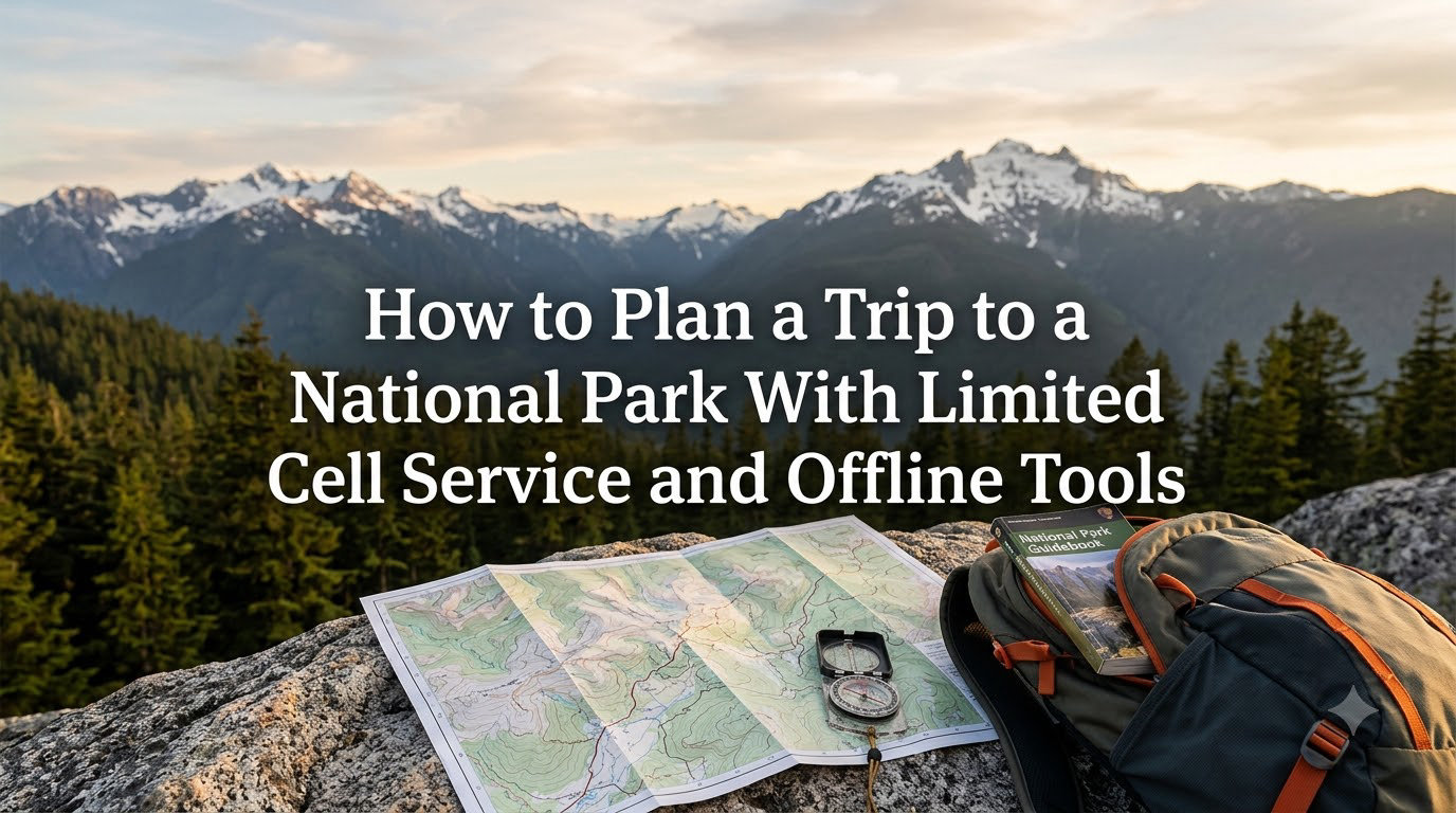
Standing at a trailhead in the middle of a national park with no cell service is a feeling every visitor should prepare for, not panic over. Our team has spent the last several years visiting remote parks where the only signal comes from a satellite overhead, and we learned the hard way that a phone with full bars at home is useless the moment you drive past the entrance station.
This guide walks through exactly how to plan a trip to a national park with limited cell service and offline tools, step by step. You will learn why coverage disappears, which offline apps actually work, how to extract GPS coordinates, which cell carrier holds up best in the backcountry, and how to set up reliable emergency communication.
The keyword here is preparation. A national park trip with no cell service goes smoothly when you download the right maps, charge the right gear, and know where to find help offline. Skip that prep and a beautiful hike can turn into a stressful guessing game. Everything below is field-tested and updated for 2026, so you can unplug and actually enjoy the park.
We have organized this into a logical flow: first, understand why signal disappears so you stop blaming your phone. Then build your at-home research routine. From there, set up your offline toolkit with specific apps and GPS waypoints, sort out carrier coverage, and lock in your emergency communication plan before you ever leave pavement.
Table of Contents
Understanding Why National Parks Have Limited Cell Service
National parks have limited cell service because they sit in remote, protected areas where building cell towers is restricted, unprofitable, and often impossible due to terrain. The same rugged mountains, deep canyons, and dense forests that make these places worth protecting also block radio signals from reaching your phone.
Cell carriers build towers where they can recover their investment, which means near cities and along major highways. A tower costs hundreds of thousands of dollars to install and needs power and fiber backhaul. A location inside Yellowstone that serves a few thousand seasonal visitors cannot justify that cost, so carriers skip it.
Terrain is the second killer. Even when a tower exists near a park boundary, the signal has to travel in a straight line to your phone. Canyons, ridgelines, thick timber, and rock walls absorb or deflect that signal. You might have four bars at the visitor center and zero bars a mile down a trail that drops into a drainage.
Forum hikers confirm this constantly. One common real-world experience reads that once you are a couple of miles from the entrance, you lose cell service even on Verizon. Another notes that cell service will be really bad or non-existent at or near national parks, full stop.
Some parks are worse than others. Big, remote parks like Yellowstone, Glacier, Joshua Tree, Death Valley, Big Bend, and Gates of the Arctic are notorious dead zones. Smaller or more developed parks like Acadia or parts of the Great Smoky Mountains hold a signal longer because roads and population centers sit closer together.
Construction and permitting also play a role. The National Park Service limits new infrastructure to protect wilderness character and wildlife, which means even willing carriers face years of environmental review before a tower can go up. That is why coverage improves slowly, if at all, inside park boundaries.
Knowing this before you arrive reframes the entire trip. You are not the victim of bad luck when bars disappear. You are entering a place designed to be wild, and the lack of signal is the price of admission. Plan for it and the disconnection becomes part of the experience.
Research and Plan Before You Leave Home
The single most important step for a national park no cell service trip happens at home, where you still have a fast connection. Every map, trail description, reservation, and emergency contact should be gathered, saved, and tested before you drive into a dead zone.
Start With the Official NPS Website
The National Park Service website at nps.gov is the authoritative source for alerts, road closures, trail conditions, fees, and hours. Read the page for the specific park you are visiting, not just the generic park landing page, because conditions change weekly.
Look for the Alerts section at the top of each park page. That banner shows current road closures, wildfire restrictions, construction, and seasonal shutdowns. A trail that was open last month may be closed for bear activity or storm damage today.
Download Park Brochures and Maps
Every park publishes an official unigrid brochure map, and most offer a downloadable PDF version on the NPS site. Save that PDF directly to your phone so it works without a connection. These maps show roads, visitor centers, campgrounds, major trails, and elevation in a format designed for exactly this scenario.
While you are at it, download the park newspaper if one is published. It contains the seasonal schedule, ranger program times, shuttle hours, and rules that change by season. Printing a hard copy as a backup is never a bad idea.
Check Trail and Road Conditions on Multiple Sources
Cross-reference NPS alerts with community sources. AllTrails has recent trip reports where hikers note downed trees, washed-out sections, and snow patches. Reddit communities like r/nationalparks and park-specific subreddits post up-to-date conditions from people who were there days ago.
Do not rely on a single source. One hiker may have visited before a storm, while another may exaggerate difficulty. Patterns across several reports give you the real picture.
Build a Written Trip Itinerary
Write down your plan for each day, including trailheads, expected return times, campground names, and backup options. Share that itinerary with someone at home who can call for help if you do not check in. This is the foundation of every backcountry safety protocol.
Keep a physical copy in your pack, not just on your phone. If your battery dies or your phone breaks, a laminated index card with your route and emergency contacts could save your life.
Make Reservations Early
Popular parks require timed-entry reservations, campground bookings, or backcountry permits that sell out months ahead. Recreation.gov handles most of these, and the competition is fierce for places like Glacier, Arches, and Yosemite. Lock these in before you start thinking about offline maps.
Check the Weather Forecast and Pack Accordingly
Pull forecasts from the National Weather Service and a mountain-specific source like Mountain-Forecast.com. Weather in parks changes fast, and a sunny valley can hide an active lightning storm above treeline. Screenshot the forecast so you have it offline, and note the daily storm window so you can plan summits for the early morning.
How to Plan a Trip to a National Park With Limited Cell Service and Offline Tools
Planning a national park trip with limited cell service and offline tools comes down to four steps: download offline maps from multiple apps, choose navigation software that works without a connection, pre-load GPS coordinates for every stop, and test the whole setup before you lose signal.
Step 1: Download Offline Maps Before You Leave
Offline maps are pre-saved map data stored on your phone so you can pan, zoom, and navigate without a data connection. The trick is that you must download them while you still have Wi-Fi or cellular data, because the files are large.
For Google Maps, use the offline maps feature to select a rectangular area around the park and save it. For Apple Maps, the offline feature works similarly on newer iOS versions. These road maps cover highways, paved roads, and major points of interest.
For trail maps, the process is different. Apps like AllTrails, Gaia GPS, and onX Backcountry let you download specific trail or area maps for offline use. The download can be hundreds of megabytes for a large park, so do it at home over Wi-Fi, not on the drive in.
Pro tip from forum users: download a larger area than you think you need. If you take a wrong turn or need to reroute to a different trailhead, that extra coverage saves you.
Check your phone storage before you start. A full set of offline maps for a week-long park trip can eat 3 to 5 gigabytes, and a phone that runs out of storage mid-download will leave you with a broken, unusable map file.
Step 2: Choose the Right Offline Navigation Apps
Different apps serve different purposes. Road navigation, trail navigation, and park-specific information each call for a different tool, and the best setup combines several.
The NPS App is the official app from the National Park Service. It covers all 400-plus park units and includes interactive maps, self-guided audio tours, trail info, and amenity locations. The critical feature is that you can download each park for full offline access, including the map, tours, and basic info. It is free and should be your first install.
AllTrails is the most popular hiking app, with millions of trails rated and reviewed by users. A paid AllTrails+ subscription unlocks offline map downloads, which include the trail line, contour lines, and waypoints. Forum hikers warn that offline navigation in AllTrails can feel clunky, but the downloaded maps do show your live GPS position on the trail line.
Gaia GPS is favored by serious backcountry users. It layers topographic maps, public land boundaries, trails, and satellite imagery, and you can download all of it for offline use. The interface is more technical than AllTrails, but the map quality and layering are excellent.
onX Backcountry and onX Off-Road are built for off-trail and off-road navigation. They show property lines, trail networks, and elevation, and they support waypoint creation. One forum note: turn-by-turn voice navigation does not always work offline in onX, so use it as a moving map, not a voice guide.
Recreation.gov handles campground and permit reservations. Download your reservation confirmations as screenshots or PDFs so you can show them at the gate without a connection.
The Dyrt and Hipcamp are worth adding if you camp outside developed campgrounds. Both let you save listings and offline directions, and user reviews include notes on cell coverage at each site, which helps you plan where signal might reappear.
Step 3: Set Up GPS Coordinates and Waypoints
GPS coordinates are the latitude and longitude numbers that pin a specific location on Earth. Your phone reads these from satellites even without cell service, which is why navigation still works offline. The key is getting those coordinates saved as waypoints before you lose signal.
Here is the process forum experts recommend. First, find your trailhead, campsites, viewpoints, and parking areas on AllTrails or Google Maps while you have a connection. Drop a pin or save the location for each one. Then export or copy the decimal-degree coordinates, which look like 44.4279, -110.5885 for Old Faithful.
Paste those coordinates into your offline navigation app of choice as named waypoints. Now, even if you have no map imagery loaded, your phone can guide you to each saved point using the GPS arrow and distance readout.
This matters because the NPS website often does not publish raw GPS coordinates for trailheads. You have to extract them yourself from another mapping tool. The Medium guide on conquering parks without cell service walks through this exact workflow, and it is one of the most under-covered skills in park planning.
Name your waypoints clearly. A list of ten points labeled parking, camp1, junction, and viewpoint is far more useful in the field than a string of untitled coordinate pins you have to puzzle out while tired and cold.
Step 4: Test Everything Before You Lose Signal
The last and most overlooked step is a dry run. Open each offline map in airplane mode at home and confirm it loads, shows your location, and lets you create routes. Charge every device to 100 percent. Screenshot your reservations and itineraries. Pack a power bank rated for at least two full phone charges.
Cold drains batteries faster, and remote parks get cold at night even in summer. A phone that lasted all day in the city may die by midafternoon at elevation. Bring a high-capacity power bank and keep your phone warm in an inner pocket when not in use.
Cell Carrier Coverage in National Parks
Cell carrier coverage in national parks varies dramatically, and Verizon consistently offers the best service in remote park areas according to years of forum reports and field testing. The margin is not close.
Verizon Has the Edge in the Backcountry
Verizon built out more rural and remote infrastructure than its competitors, and that shows in national parks. Across dozens of forum threads, the consensus reads that Verizon is unequivocally the best choice for backcountry coverage, not even close. AT&T often comes in second, with usable signal near developed areas and some trailheads.
T-Mobile ranks third in most park coverage reports, though its recent rural expansion and the Sprint network integration have improved coverage in some western parks. Still, do not count on T-Mobile alone for backcountry safety.
Do Not Expect Signal Away From Development
No carrier changes the basic physics. Once you hike a couple of miles from a visitor center, campground, or lodge, signal usually disappears for everyone. Plan as if you will have zero bars for the bulk of your trip.
Wi-Fi at Visitor Centers
Many parks offer free Wi-Fi at the main visitor center, but it is often slow, capped, or limited to a small area. Some parks, like Yellowstone, have Wi-Fi at select lodges for guests. Treat visitor center Wi-Fi as a bonus for sending a quick text home, not as a reliable planning tool.
5G and Park Dead Zones
5G deployment in national parks is minimal. Where 5G exists, it tends to be at developed hubs, not on trails or scenic drives. Do not buy a phone or plan specifically for 5G park coverage. The reliable signal in these places is still 4G LTE, if you get any signal at all.
Wi-Fi Calling as a Bridge
If your carrier supports Wi-Fi calling, turn it on before your trip. When you connect to visitor center or lodge Wi-Fi, you can place and receive calls and texts over that connection. It is a useful lifeline at developed stops even when cellular service is dead.
Check Park-Specific Coverage Maps
Carrier coverage maps on the Verizon, AT&T, and T-Mobile websites are optimistic, but the RootMetrics and Opensignal reports give a more honest picture. Reddit threads for specific parks like r/GlacierNationalPark and r/JoshuaTree also include trip reports naming exactly where each carrier held a signal. Use those to set realistic expectations before you go.
Emergency Communication Without Cell Service
Emergency communication without cell service requires a dedicated device or service that does not rely on cell towers, because a phone alone will not reach help in most backcountry situations. Planning for this is the difference between a minor incident and a crisis.
Satellite Communicators
Satellite communicators are handheld devices that send messages and SOS signals through satellite networks like Iridium or Globalstar. The Garmin inReach Mini 2 is the most widely recommended model among hikers and rangers. It lets you send preset and custom text messages, share your location, and trigger a two-way SOS that connects to a 24-hour rescue coordination center.
The ZOLEO satellite communicator is another popular option. It pairs with your phone over Bluetooth and automatically routes messages over satellite, Wi-Fi, or cellular, whichever is available. Both devices require a monthly subscription, so factor that into your trip budget.
For a national park no cell service trip that includes real backcountry, a satellite communicator is the single best safety investment you can make.
Personal Locator Beacons
Personal locator beacons, or PLBs, are single-purpose devices that broadcast a distress signal to search and rescue satellites on the 406 MHz frequency. Unlike satellite communicators, they have no messaging and no subscription fee, but they are registered to you and broadcast your location when activated.
PLBs are a good choice if you only want emergency backup and never plan to message home. They sit dormant for years on a single battery and activate only in a true emergency.
Smartphone Satellite SOS
Recent iPhones and Google Pixel phones include built-in satellite SOS for emergencies. Apple Emergency SOS via satellite and Google’s equivalent let you text emergency services from areas with no cellular coverage. Coverage and availability vary by country and region, and the feature is intended for emergencies only, not casual messaging.
This is a powerful backup, but it does not replace a two-way satellite communicator for group trips or longer expeditions where you want to message contacts at home.
Leave a Trip Plan With a Trusted Contact
No device replaces a written trip plan left with someone reliable. Give that person your route, trailheads, expected return time, vehicle description, and the phone number for the park dispatch or county sheriff. Agree on a check-in schedule and what they should do if you miss it.
This is free, requires no batteries, and has initiated countless successful rescues. Make it non-negotiable for any backcountry trip.
Know the Local Rescue Number
911 works when you have any cell signal, even roaming. In a total dead zone, you need the direct number for the county sheriff or park dispatch, because 911 routing depends on cell towers. Write those numbers on your paper itinerary.
Use Visitor Centers and Park Rangers as Your Live Search
Visitor centers and park rangers are the most reliable real-time information source in any national park, more accurate than Google and more current than downloaded apps. When you cannot search the internet, the people inside these buildings are your search engine.
What Rangers Know That Apps Do Not
Rangers live in the park. They know which trail washed out last week, where the bear activity is concentrated, which campground still has first-come sites, and whether the high pass is snow-free. Forum hikers consistently report that rangers are knowledgeable and accurate, better than Google sometimes.
Stop at the visitor center before you hit the trail, even if you downloaded everything. Conditions change between when you planned at home and when you arrive. A five-minute conversation with a ranger can save you a wasted day or a dangerous mistake.
Resources Available at Visitor Centers
Visitor centers stock free paper maps, trail guides, junior ranger booklets, and current conditions boards. Many sell detailed topographic maps and guidebooks for the serious planner. The backcountry office inside or nearby handles permit pickups, bear canister rentals, and route-specific advisories.
Use the visitor center Wi-Fi if available to send a check-in message home or download any last-minute updates. Then head out prepared.
Backcountry Permit Offices
If you are doing an overnight backcountry trip, the permit office is mandatory. Rangers there review your route, warn you about hazards, check your gear, and issue the permit that makes your trip legal. Treat this conversation as a free expert consultation, not a formality.
Paper Maps and Analog Backups
Paper maps are the fail-safe backup that never runs out of battery, never loses GPS lock, and works in any weather. Every serious backcountry plan includes a paper map and compass as the last line of defense.
Why Paper Still Matters
Phones fail. Batteries die, screens crack in cold, devices get dropped in rivers. A laminated topographic map and a basic compass weigh almost nothing and work in every condition. If your phone dies on day two of a three-day trip, paper is what gets you back to the trailhead.
Where to Get Park Maps
The official park brochure is free at the entrance and visitor center. For more detail, the USGS publishes 7.5-minute topographic quads covering every park, available free as PDFs from the USGS store online. Specialty companies like National Geographic Trails Illustrated produce waterproof plastic maps for popular parks.
Buy or print your paper map before the trip. Visitor centers sometimes sell out of popular quads during peak season.
Compass Basics
A baseplate compass lets you orient your paper map to north, take bearings to landmarks, and follow a heading. You do not need advanced navigation skills, but you should know how to match the map to the terrain and walk a bearing. Practice at home before relying on it in the field.
Common Mistakes Visitors Make Without Cell Service
The biggest mistakes visitors make in national parks with limited cell service all stem from one error: assuming connectivity will be there when it is not. Here are the missteps that cause the most problems.
- Relying on streaming navigation. Drivers who launch Google Maps expecting live traffic and rerouting find themselves staring at a blank screen miles from the trailhead. Download offline maps before you leave home.
- Not downloading content in advance. Apps, reservations, music, podcasts, and park guides all need to be saved while you have a connection. Waiting until you arrive is too late.
- Skipping the visitor center. Visitors who blow past the entrance and head straight for the trail miss free maps, current conditions, and ranger advice that could prevent a bad day.
- Trusting phone GPS without offline maps. Phone GPS shows your blue dot, but without downloaded map imagery the dot sits on a blank background. You need both.
- Underestimating battery drain. Phones working hard to find a signal, plus cold weather and GPS use, drain batteries fast. Many hikers run out of power by mid-afternoon.
- No emergency plan. Heading into the backcountry without a satellite communicator, a trip plan left with someone, or local rescue numbers is a gamble with real consequences.
- Ignoring posted warnings. Trail closure signs, bear warnings, and weather alerts exist for a reason. Without a phone to fact-check, follow them.
Offline Preparation Checklist
Run through this checklist before you lose cell service. If you can check every box, you are ready for a national park no cell service trip.
- Download the NPS app and save your park for offline use.
- Download offline Google or Apple Maps covering the park and surrounding area.
- Download trail maps in AllTrails, Gaia GPS, or onX for every route you plan to hike.
- Save GPS coordinates for trailheads, campsites, and viewpoints as waypoints.
- Print or save park brochures, itineraries, and reservation confirmations.
- Write a trip plan and leave it with a trusted contact.
- Charge all devices fully and pack a power bank rated for at least two phone charges.
- Test every offline map in airplane mode at home.
- Carry a paper topographic map and compass.
- Pack a satellite communicator or confirm satellite SOS on your phone for backcountry trips.
- Write down the county sheriff and park dispatch numbers on paper.
- Check NPS alerts and trail reports one final time the night before.
Frequently Asked Questions
What is the hiking app that works offline?
AllTrails, Gaia GPS, and onX Backcountry are the most reliable hiking apps that work offline. AllTrails+ lets you download trail maps with contour lines and waypoints for offline navigation. Gaia GPS offers layered topographic and satellite maps for backcountry use. The official NPS app also supports full offline downloads for each park, including interactive maps and self-guided tours.
Can you use the NPS app offline?
Yes, you can use the NPS app offline. Download the park you plan to visit while you have a connection, and the interactive map, self-guided tours, trail info, and basic content all work without cell service. The download can be several hundred megabytes for large parks, so save it over Wi-Fi before your trip.
Do cell phones work in Zion National Park?
Cell service in Zion National Park is spotty and concentrated near the Zion Canyon Visitor Center, Springdale, and developed areas. Signal drops off quickly along the canyon road and on most trails. Verizon offers the best coverage, but expect dead zones in the canyon and on popular hikes like Angels Landing and The Narrows.
Why do national parks have no cell service?
National parks have no cell service because they are located in remote, protected areas where building cell towers is restricted by law, unprofitable for carriers, and blocked by rugged terrain. Mountains, canyons, and dense forest absorb radio signals, so even nearby towers cannot reach phones deep inside the park.
What are the biggest mistakes visitors make at national parks?
The biggest mistakes visitors make are relying on streaming navigation without downloading offline maps, skipping the visitor center, underestimating battery drain, ignoring posted trail warnings, and heading into the backcountry without a satellite communicator or a trip plan left with someone at home. Each of these turns a minor setback into a safety risk when cell service disappears.
How is the cell service in Joshua Tree?
Cell service in Joshua Tree National Park is extremely limited across most of the park. There is some signal near the entrances and at a few high points along paved roads, but the interior and nearly all trailheads are dead zones for every carrier. Download offline maps and bring a satellite communicator for any backcountry activity.
Conclusion
Learning how to plan a trip to a national park with limited cell service and offline tools turns a potential headache into a non-issue. Download your maps at home, pick the right offline apps, save your GPS coordinates as waypoints, confirm your carrier coverage, and pack an emergency communication plan before you drive past the entrance sign.
The parks reward the prepared. Once your offline toolkit is set, you get to do the thing you came for: unplug, explore, and let the landscape do the talking. Use the checklist above, test everything in airplane mode, and your next national park no cell service trip will run smoothly from trailhead to trailhead.