
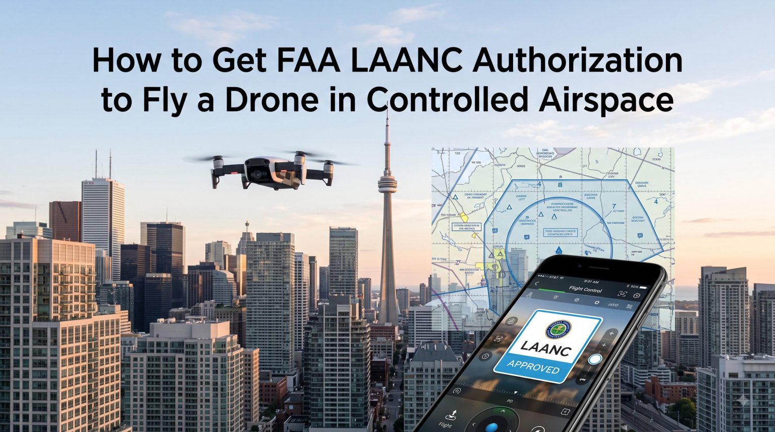
Flying a drone in controlled airspace near airports without permission can land you in serious trouble with the FAA. The good news is that getting FAA LAANC authorization for your drone has never been faster or more straightforward. I have walked dozens of new pilots through this process, and once you understand the system, approval often takes less than 30 seconds.
This guide breaks down everything you need to know about how to get FAA LAANC authorization to fly a drone in controlled airspace. We will cover what LAANC is, the prerequisites you must complete first, the exact step-by-step application process, how to read UAS Facility Maps, and what to do when LAANC is not available at your location.
Whether you fly recreationally on weekends or operate commercially under Part 107, the steps below apply to you. The FAA updated several LAANC rules in 2026, and I will flag those changes as we go so you stay compliant.
Table of Contents
What Is LAANC and Why You Need It
LAANC stands for Low Altitude Authorization and Notification Capability. It is an automated system jointly managed by the FAA and private companies called UAS Service Suppliers (USS) that delivers near real-time airspace authorization for drone pilots.
Before LAANC existed, getting permission to fly near an airport meant submitting a manual request through the FAA Drone Zone and waiting days, sometimes weeks, for a response. That process frustrated pilots and discouraged safe, authorized flying. LAANC changed all of that by automating approvals against pre-established altitude grids around participating airports.
Here is the core idea: the FAA publishes maximum allowable flight altitudes around controlled airports using a grid system. When you request authorization through a LAANC app, the system checks your requested altitude against that grid. If your request falls within the pre-approved ceiling, you get an instant authorization.
You need LAANC authorization because federal law requires explicit FAA approval before operating a drone in controlled airspace. Controlled airspace includes the areas around airports where Air Traffic Control manages manned aircraft. Flying there without authorization violates FAA regulations and can result in fines, certificate suspension, or worse.
As of 2026, over 730 airports across the United States participate in the LAANC system. That covers a massive portion of the controlled airspace where recreational and commercial pilots typically want to fly. Coverage expands regularly as more airports and USS providers join the program.
One thing I always emphasize to new pilots: LAANC gives you airspace authorization, not airspace waiver. You still must follow all other drone rules, including the 400-foot maximum altitude for recreational flyers and Visual Line of Sight requirements.
When You Need LAANC vs When You Don’t
You need LAANC authorization any time you plan to fly in controlled airspace, which the FAA defines as Class B, Class C, Class D, and the surface area of Class E airspace around airports. These classifications surround most towered airports and busy aviation facilities.
In uncontrolled airspace (Class G), you do not need LAANC. You can fly freely as long as you follow standard drone regulations like the 400-foot altitude limit and Visual Line of Sight rules.
The confusion I see most often involves Class E airspace. Not all Class E requires authorization. You only need LAANC for the Class E surface area, which extends upward from ground level around certain airports. Class E that starts at 700 feet or 1,200 feet above ground does not require LAANC because recreational and Part 107 pilots already stay below 400 feet.
Here is a quick breakdown of when authorization is required:
Class B: Always requires authorization. These surround the busiest major airports.
Class C: Always requires authorization. These surround medium-sized commercial airports with control towers and radar.
Class D: Always requires authorization. These surround towered airports with moderate traffic.
Class E surface area: Requires authorization when it surrounds an airport that has a published instrument approach.
Class G (uncontrolled): No authorization needed. Just follow standard drone rules.
The easiest way to check your airspace class is to open any LAANC app or an app like Aloft, B4UFLY, or AirMap. They automatically detect your location and show whether you are in controlled airspace that requires authorization.
Prerequisites Before You Apply
You cannot jump straight into the LAANC system without completing a few FAA requirements first. These prerequisites apply to everyone, whether you fly for fun or for money. I recommend knocking these out before you even download a LAANC app so you are ready to fly the moment you need authorization.
Register Your Drone With the FAA
Every drone weighing more than 0.55 pounds (250 grams) must be registered with the FAA before flight. Registration costs five dollars and covers all your drones for three years. You complete this through the FAA Drone Zone portal at faadronezone.faa.gov.
Recreational flyers register under The Exception for Limited Recreational Operations of Unmanned Aircraft. Commercial operators flying under Part 107 register each aircraft individually under their Part 107 certificate number. Either way, your registration number must be displayed on the exterior of your drone.
Take the TRUST Test (Recreational Flyers Only)
If you fly recreationally, you must complete The Recreational UAS Safety Test, known as TRUST. This is a free online safety test administered by FAA-approved organizations like the Academy of Model Aeronautics and the Boy Scouts of America.
TRUST covers basic safety knowledge, airspace rules, and emergency procedures. It takes about 15 to 30 minutes, and you must pass all questions. Once you complete it, you receive a completion certificate that you should carry with you when flying. The certificate does not expire, but you should retake the test if the FAA updates its content.
Commercial Part 107 operators do not need TRUST. Instead, you must hold a valid Remote Pilot Certificate, which requires passing the Part 107 knowledge test at an FAA-approved testing center. That is a much more rigorous exam covering weather, airspace, regulations, and aeronautical decision-making.
Get Your Remote ID Compliant
Since 2023, all drone pilots must comply with Remote ID rules. Remote ID is essentially a digital license plate for your drone that broadcasts identification and location information.
You can satisfy Remote ID three ways: fly a drone with built-in Standard Remote ID, attach a broadcast module to a non-compliant drone, or fly at an FAA-Recognized Identification Area (FRIA). Most drones sold in 2026 come with Standard Remote ID built in, so this requirement is easier than ever to meet.
Know Your Operator Category
Your prerequisites differ based on whether you fly recreationally or commercially. Recreational flyers need registration, TRUST, and Remote ID. Commercial operators need registration, a Part 107 certificate, and Remote ID.
The LAANC system treats both groups slightly differently in terms of what altitude and operational restrictions apply. I will cover those differences in the step-by-step section below.
How to Get FAA LAANC Authorization to Fly a Drone in Controlled Airspace
This is the heart of the guide. Follow these steps in order, and you will have your LAANC authorization within minutes. I have used this exact process hundreds of times, and it works reliably across all the major LAANC apps.
Step 1: Choose and Install a LAANC App
Download a FAA-approved LAANC application. The most popular options include Aloft Air Control (free), AirHub Portal by Airspace Link (free), and several other USS apps. You do not pay for the app or the authorization. I recommend starting with Aloft because it has the cleanest interface and processes a huge share of all LAANC requests nationwide.
Create an account using your email address. You will need to verify your identity and agree to the terms of service. The app will ask whether you are a recreational flyer or a Part 107 commercial operator, so have that information ready.
Step 2: Verify Your Prerequisites Are Complete
Before requesting authorization, make sure your drone is registered, your TRUST or Part 107 credentials are in order, and your Remote ID is active. The app may ask you to confirm these items, and flying without them invalidates your authorization even if LAANC approves it.
Have your drone registration number handy. Some apps ask for it during the authorization request. If you fly under Part 107, have your Remote Pilot Certificate number available as well.
Step 3: Select Your Flight Location
Open the app and navigate to the location where you plan to fly. The app’s map display shows controlled airspace boundaries as shaded areas around airports. If your location falls within one of these shaded zones, you need authorization.
Tapping on the airspace area brings up details about the controlling facility, the airspace class, and the maximum pre-approved altitude from the UAS Facility Map. This information determines what altitude you can request through LAANC.
Step 4: Check the UAS Facility Map Grid
The UAS Facility Map shows the maximum altitude that LAANC will automatically approve for each grid cell around an airport. Grid numbers are expressed in feet above ground level (AGL). For example, a grid showing 200 means LAANC can automatically authorize flights up to 200 feet in that cell.
If the grid shows zero, LAANC cannot authorize your flight automatically. You would need to submit a manual request through the FAA Drone Zone instead. I cover that process in a later section.
Step 5: Enter Your Flight Details
Specify your requested maximum altitude, your flight start time, and your flight duration. You can request authorization up to 90 days in advance, which is helpful for planning commercial shoots or events.
The duration of your authorization depends on your operator category. Recreational flyers typically get shorter windows, while Part 107 operators can request longer periods. The app shows you the maximum allowed duration for your category.
Select the grid cell or draw your flight area on the map. Make sure your requested altitude does not exceed the UAS Facility Map ceiling for that cell. If you request more than the grid allows, LAANC will reject the automatic approval.
Step 6: Submit and Receive Instant Authorization
Review your request and hit submit. In most cases, the system returns an approval within seconds. You will see a confirmation screen with your authorization details: the approved altitude, the time window, the grid cell, and your authorization reference number.
Save this confirmation. Some apps generate a PDF or allow you to email the authorization to yourself. Having documentation of your approval protects you if anyone questions your flight, including law enforcement or airport security.
Step 7: Follow All Authorization Conditions
Your LAANC authorization is only valid for the altitude, location, and time window specified. Flying higher, longer, or in a different area violates your authorization. If conditions change and you need a different altitude or time, submit a new request.
Always carry proof of your authorization while flying. Most apps let you display it on your phone. I also recommend screenshotting the approval in case you lose cell service at your flight location.
Choosing a LAANC App
The FAA does not run its own LAANC app. Instead, it authorizes private companies called UAS Service Suppliers to provide LAANC services. You have several free options, and they all connect to the same underlying FAA system. The difference comes down to interface, extra features, and personal preference.
Here is a comparison of the most popular LAANC apps available in 2026:
Aloft Air Control: The most widely used LAANC app. Free, clean interface, and handles a massive share of all monthly LAANC authorizations. Includes flight logging and airspace awareness features. Available on iOS and Android.
AirHub Portal by Airspace Link: A free web and mobile platform. Good for pilots who prefer planning on a larger screen. Includes detailed airspace data and local advisories.
B4UFLY: The FAA’s official airspace awareness app. While primarily for checking airspace restrictions, it also integrates with LAANC providers for authorization. Great first stop before you fly.
Other USS providers: Several additional FAA-approved providers offer LAANC, including Robinson Aviation, Avision, and others. All deliver the same core authorization service.
You can use multiple apps interchangeably. The authorization is tied to your flight details and the FAA system, not to a specific app. I use Aloft for most flights because the interface is fast and reliable, but I keep B4UFLY installed for quick airspace checks.
One important note: all LAANC apps are free for pilots. If any app asks you to pay for basic LAANC authorization, it is not an approved USS. Stick with the apps listed on the FAA’s official LAANC page.
How to Read UAS Facility Maps
UAS Facility Maps, sometimes called UASFM, are the backbone of the LAANC system. They display the maximum altitude that LAANC can automatically approve for drone flights in each grid cell surrounding participating airports. Understanding how to read them prevents rejected requests and wasted time.
The FAA divides the airspace around each airport into grid cells. Each cell displays a number representing the maximum approvable altitude in hundreds of feet above ground level. For example, a cell labeled 4 means LAANC can approve flights up to 400 feet, while a cell labeled 2 caps approval at 200 feet.
Here is what common grid numbers mean:
4 (400 feet): Full recreational and Part 107 altitude available. The most common grid value in less congested airport areas.
2 (200 feet): Lower ceiling, typically closer to runways or approach paths. You must keep flights at or below 200 feet.
1 (100 feet): Very restrictive, usually near active runway zones. Only low-altitude operations possible.
0 (zero feet): LAANC cannot authorize any flight in this cell. You must use the FAA Drone Zone for manual authorization.
Grid values change as you move away from the airport. Cells closest to runways tend to show zero or low values, while cells farther out often show 400 feet. This graduated system allows LAANC to grant instant approval in safer areas while routing tighter restrictions through manual review.
When I plan a flight, I always check the UAS Facility Map before opening the LAANC app. If my desired location falls in a zero-foot grid, I know immediately to switch to the Drone Zone process rather than wasting time on a request that will be rejected. You can view UAS Facility Maps directly through your LAANC app or on the FAA website.
Keep in mind that UAS Facility Maps show the maximum LAANC-approvable altitude, not necessarily the altitude you should fly. Other factors, including obstacles, manned aircraft traffic patterns, and local conditions, may warrant flying lower than the grid maximum.
The FAA Drone Zone Alternative
Not every controlled airspace location has LAANC coverage, and some grid cells show zero feet where LAANC cannot help. In those cases, you need the FAA Drone Zone for manual airspace authorization.
The FAA Drone Zone is the FAA’s official web portal for all drone-related services, including registration, waiver applications, and airspace authorizations. You access it at faadronezone.faa.gov using a free account.
Here is how the manual authorization process works:
Log into the FAA Drone Zone and select Airspace Authorization.
Enter your flight location, requested altitude, date, and duration.
Provide operational details, including your drone type and purpose of flight.
Submit and wait for FAA review.
The big downside is wait time. Manual authorizations can take anywhere from a few days to several weeks depending on the facility and the complexity of your request. Forum discussions on Reddit consistently highlight this frustration, with pilots reporting waits of two to four weeks for non-LAANC approvals.
One tip from experienced pilots: if you need ongoing or recurring authorization for a non-LAANC location, use specific language in your request. Ask for a recurring authorization covering a set period rather than a single flight. Some operators have successfully obtained multi-week or seasonal authorizations by clearly stating their recurring needs.
I always recommend checking LAANC first. Only fall back to the Drone Zone when LAANC shows zero-foot coverage or your desired altitude exceeds the grid ceiling. If your flight is time-sensitive and falls in a zero-foot area, plan well ahead.
Troubleshooting Common LAANC Problems
Even with a solid understanding of the process, things can go wrong. These are the most common LAANC issues pilots encounter and how to resolve them based on real experiences shared across drone forums and my own testing.
Problem: LAANC Shows a Zero-Foot Ceiling
This means the UAS Facility Map for your exact location shows zero feet, so LAANC cannot approve any altitude automatically. Your options are to move your flight to a nearby grid cell with a higher ceiling, request manual authorization through the FAA Drone Zone, or contact the controlling ATC facility directly for coordination.
Problem: Requested Altitude Exceeds the Grid Maximum
If you request 400 feet but the grid only allows 200 feet, the LAANC system rejects your request. Lower your requested altitude to match or stay below the grid value and resubmit. The app usually warns you before submission if your request exceeds the ceiling.
Problem: Authorization Expired Before You Finished Flying
LAANC authorizations have strict time windows. If your flight runs long, submit a new authorization request before the original expires. Never continue flying past your authorized window, even by a few minutes. Most apps send a notification when your window is about to end.
Problem: LAANC Not Available at Your Airport
Not every controlled airport participates in LAANC, particularly smaller municipal fields. If your airport does not appear in the LAANC app, use the FAA Drone Zone for manual authorization. Coverage is expanding, so check periodically if your local airport is not yet supported.
Problem: App Cannot Verify Your Location
This usually relates to GPS or permissions settings on your phone. Make sure location services are enabled for the app and that you have a clear view of the sky for GPS accuracy. Restarting the app resolves most temporary glitches.
Night Operations and LAANC
Flying at night under LAANC is allowed, but specific rules apply. Since the FAA updated its regulations, both recreational flyers and Part 107 operators can fly at night without a separate waiver, provided they meet lighting requirements.
For night operations, your drone must be equipped with anti-collision lighting visible for at least three statute miles. The light must have a flash rate sufficient to avoid collision. Most modern drones include built-in strobe lights that satisfy this requirement, but you should verify before flying.
When you request LAANC authorization for a night flight, the process is identical to daytime. Select your time window for the hours after civil dusk, and the system approves based on the same altitude grids. LAANC does not apply different altitude ceilings for night flights.
Part 107 operators must have completed the updated Part 107 knowledge test or the online training module covering night operations. Recreational flyers do not need additional testing for night flying, but I strongly recommend extra caution and conservative altitudes when flying in the dark.
One common mistake: some pilots assume LAANC authorization covers them regardless of time of day. Always check that your authorized time window matches your actual flight time. If you start at dusk and fly into the night, make sure your authorization window includes those hours and that your lighting is active.
FAQs
How do I get airspace authorization for my drone?
To get airspace authorization for your drone, register your drone with the FAA, complete the TRUST test (recreational) or hold a Part 107 certificate (commercial), then download a free LAANC app like Aloft Air Control. Select your flight location, choose an altitude within the UAS Facility Map grid limit, and submit your request. Most approvals arrive in under 30 seconds for participating airports.
How do I get permission to fly in restricted airspace?
Permission to fly in controlled airspace near airports comes through LAANC for participating locations or the FAA Drone Zone for non-LAANC areas. Open a LAANC app, verify your location falls in controlled airspace, request your altitude and time window, and receive instant approval if within grid limits. For zero-foot grids or unsupported airports, submit a manual request through faadronezone.faa.gov.
How is LAANC authorization obtained?
LAANC authorization is obtained through an FAA-approved UAS Service Supplier app such as Aloft, AirHub Portal, or B4UFLY. You create a free account, confirm your drone registration and pilot credentials, select your flight area on the map, enter your desired altitude and time window, and submit. The system checks your request against UAS Facility Map grids and returns near-real-time approval.
Do I need LAANC in uncontrolled airspace?
No, you do not need LAANC authorization in uncontrolled Class G airspace. LAANC is only required in controlled airspace (Class B, C, D, and Class E surface areas) around airports. In Class G airspace, fly freely as long as you follow standard rules like the 400-foot altitude limit, Visual Line of Sight, and Remote ID requirements.
What is the difference between LAANC and the FAA Drone Zone?
LAANC provides instant automated authorization through an app for participating airports and altitudes within grid limits. The FAA Drone Zone handles manual authorization requests for non-LAANC airports, zero-foot grid areas, or altitudes exceeding grid ceilings. LAANC approvals take seconds while Drone Zone requests can take days to weeks.
How long does a non-LAANC FAA authorization take?
Non-LAANC authorization through the FAA Drone Zone typically takes several days to a few weeks depending on the facility and request complexity. Pilots on drone forums report waits ranging from two to four weeks for some locations. Submit requests well in advance and consider asking for recurring authorization if you fly regularly at the same non-LAANC site.
Conclusion
Getting FAA LAANC authorization to fly a drone in controlled airspace is fast, free, and straightforward once you complete the prerequisites. Register your drone, pass TRUST or hold your Part 107 certificate, satisfy Remote ID, then use any free LAANC app to request instant approval based on UAS Facility Map grids.
For locations where LAANC is not available or grid ceilings show zero feet, the FAA Drone Zone provides the manual path to authorization. Plan ahead for those cases since manual approvals take longer.
The system exists to keep the skies safe while giving pilots reasonable access to controlled airspace. Follow the steps above, carry proof of your authorization, and fly responsibly. Welcome to legal, authorized drone flying in 2026.