
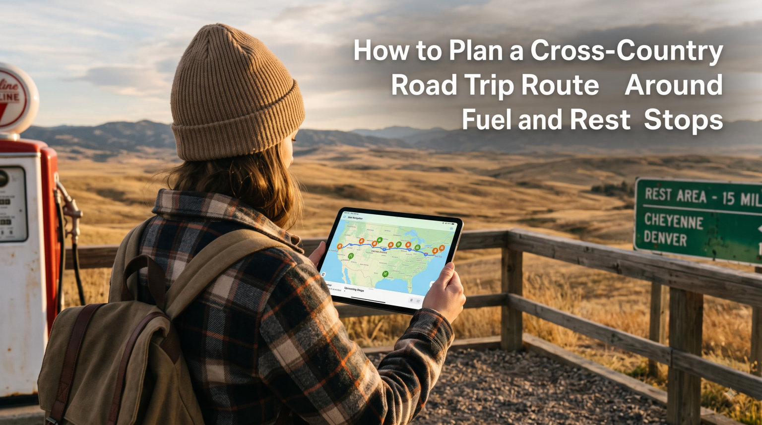
I have driven across the United States three times, and every single trip taught me the same lesson. The difference between a smooth cross-country adventure and a stressful ordeal comes down to one thing: planning your fuel and rest stops before you ever turn the key.
Learning how to plan a cross-country road trip route around fuel and rest stops is the single most valuable skill for any long-distance driver. It keeps you safe, saves you money, and prevents those stomach-dropping moments when your fuel gauge dips below a quarter tank in the middle of nowhere.
In this guide, I will walk you through every step of the process. You will learn how to calculate driving distances, map fuel stops with precision, identify no-service stretches before you hit them, choose the right planning tools, and build a driving schedule that keeps you alert and on budget.
Whether you are a first-time road tripper nervous about crossing remote desert highways or a seasoned driver looking to optimize your fuel costs, this article gives you a complete framework. I have pulled together strategies from hundreds of road trip forum discussions, real driver experiences, and my own cross-country miles to create a planning system that works.
Table of Contents
What Is the 3-3-3 Rule for Road Trips?
The 3-3-3 rule is a simple framework that experienced road trippers use to keep their journeys safe and enjoyable. The rule suggests driving no more than 300 miles per day, arriving at your destination by 3:00 PM, and staying at least three nights in each overnight location.
When I first heard about this rule on a road trip forum, I was skeptical. I wanted to cover 600 miles a day to get across the country faster. But after trying both approaches, I can tell you the 3-3-3 rule makes a dramatic difference in how you feel and how safely you drive.
For fuel and rest stop planning specifically, the 300-mile daily limit matters most. Most vehicles can travel 300 to 400 miles on a full tank, which means a single fuel stop at the halfway point of your day keeps you comfortably above empty. You are never pushing your range or worrying about finding a station in a remote stretch.
The 3:00 PM arrival target also plays into rest stop planning. Arriving early gives you daylight to find your accommodation, locate nearby gas stations for the next morning, and scout rest areas for the following day’s drive. It eliminates the stress of searching for fuel in an unfamiliar town after dark.
The three-night minimum is less about driving safety and more about trip quality. But it does mean you can thoroughly map out the fuel and rest stops for your next leg without rushing. You have time to research no-service stretches, compare gas prices in the area, and plan your departure time for the cleanest drive.
How to Calculate Driving Distances and Time for Your Route
Calculating driving distances accurately is the foundation of every good route plan. Most beginners make the mistake of trusting Google Maps’ estimated arrival time without factoring in stops, and that mistake can leave you driving exhausted well past your planned stopping point.
Here is the formula I use after three cross-country trips. Take the total distance in miles and divide by 55.
That number 55 represents your realistic average speed including traffic, speed limit changes through small towns, and construction zones. Google Maps assumes closer to 65 mph in many areas, which is optimistic for cross-country travel.
For example, a 350-mile day at 55 mph means about 6.5 hours of pure driving time. But you need to add stops to that number.
Plan for 15 minutes at each rest stop, 20 minutes at each fuel stop, and 30 to 60 minutes for meals. If you stop three times during a 350-mile day, add roughly 75 to 90 minutes to your total.
So that 350-mile day actually takes about 8 hours from the time you start the engine to the time you park for the night. Understanding this real-world calculation prevents you from over-planning your daily mileage.
I also recommend tracking your driving in 100-mile increments. Every 100 miles, check your fuel gauge, assess how you feel physically, and confirm your next planned stop is still on track. This habit keeps you ahead of problems instead of reacting to them.
One more tip from the road trip forums that has served me well: always add a 20% time buffer to whatever you calculate. If you think a leg will take 8 hours, plan for 10. Road work, weather, detours, and spontaneous scenic stops eat into your schedule faster than you expect.
How to Map Fuel Stops Along Your Route
Mapping fuel stops is the heart of planning a cross-country road trip route around fuel and rest stops. The goal is simple: never let your tank drop below a quarter full, and always know where your next gas station is before you need it.
Before you map anything, you need to know your vehicle’s real-world range. Do not trust the manufacturer’s stated range.
Instead, fill your tank, reset your trip odometer, and drive normally until you refuel. Note how many miles you covered on that tank.
Most sedans get 350 to 450 miles per tank. SUVs and trucks typically get 300 to 400 miles. RVs and large vehicles might only get 200 to 250 miles per fill-up.
Once you know your range, apply the 25% rule. If your tank holds 400 miles worth of fuel, start looking for a gas station at the 300-mile mark. This gives you a 100-mile cushion for situations where the nearest station is farther than expected or temporarily closed.
Here is the step-by-step fuel stop mapping process I use for every trip:
Step 1: Plot your entire route in Google Maps or your preferred route planner. Note the total distance and break it into daily segments based on your mileage goals.
Step 2: For each daily segment, identify the halfway point. This is your primary fuel stop location. Search for gas stations near that point on the map.
Step 3: Check for no-service stretches along each segment. I will cover how to identify these in the next section, but the key is knowing where stations are sparse.
Step 4: Use GasBuddy to check fuel prices at stations along your route. Forum users consistently recommend this app for finding the cheapest gas. Price differences between stations can be 40 to 60 cents per gallon, which adds up fast on a cross-country trip.
Step 5: Mark backup fuel stations. For every planned stop, note one or two alternatives within 20 miles in case your primary station is closed, crowded, or out of fuel.
Step 6: Download offline maps of your route. Cell service drops out in remote areas, and you do not want to lose your fuel stop locations when you need them most.
Experienced road trippers on Reddit’s road trip community report planning fuel stops every 180 to 220 miles for vehicles with a 300-mile range. This conservative approach has saved me more than once, especially crossing Nevada and Utah where stations can be 80 to 100 miles apart.
One tool that forum users swear by for finding truck stops with full amenities is the Love’s Connect app. Truck stops like Love’s, Pilot, and TravelCenters of America typically have clean restrooms, food options, and reliable fuel pumps. They are my go-to choice for primary fuel stops whenever available.
How to Identify Rest Stops and No-Service Stretches
Rest stops and no-service stretches are two sides of the same coin. Rest stops are the official highway areas where you can pull over, use facilities, walk around, and rest. No-service stretches are the gaps between civilization where no gas stations, restaurants, or restrooms exist for 50 to 100 miles or more.
Every state’s Department of Transportation publishes a list of rest areas along interstate highways. You can find these on state DOT websites, and they typically include details about amenities like restrooms, vending machines, picnic areas, and whether the stop is open 24 hours. I always check the DOT websites for states on my route before departure.
The Interstate Rest Area app and website also compiles rest stop information across all 50 states. It shows locations, amenities, and user reviews. This is faster than checking individual state sites and works well for cross-country route planning.
Now let us talk about no-service stretches, because these are where road trips go wrong. A no-service stretch is any section of highway where you cannot find fuel, food, or restrooms for an extended distance. They exist on nearly every cross-country route, and not knowing about them can leave you stranded.
Some of the most notorious no-service stretches in the United States include Interstate 70 through eastern Utah and western Colorado, where stations can be 70 to 100 miles apart. The stretches of US-50 through Nevada, famously called the Loneliest Road in America, have gaps of 80-plus miles between services.
Interstate 10 through west Texas has long stretches with nothing but desert. Interstate 90 through South Dakota and Wyoming can have sparse services, especially in winter when some stations close. And anything crossing the Great Basin region of Nevada, Utah, and Oregon demands careful fuel planning.
Here is how I identify no-service stretches before a trip. I zoom into my route on Google Maps and switch to satellite view.
Then I scan the highway for clusters of buildings that indicate towns or service areas. Where I see long gaps between clusters, I note those as no-service zones.
The iOverlander app, which forum users recommend for finding fuel stops and rest areas in remote regions, is another excellent resource. It uses crowdsourced data from overlanders and RV travelers who mark fuel stations, rest stops, and overnight parking spots across the country.
Once you identify a no-service stretch, the strategy is simple. Fill your tank at the last station before the gap begins.
Do not assume you can make it on what is left. Top off, check your fuel gauge, and mentally commit to not stopping for fuel until you reach the other side.
I also recommend noting the distances. If a no-service stretch is 85 miles long, write that down. Knowing the exact distance helps you decide whether you have enough fuel to cross it or whether you need to fill up earlier than planned.
Best Tools and Apps for Route Planning
The right tools make planning a cross-country route dramatically easier. After testing most of the popular road trip planning apps over multiple cross-country drives, I have settled on a combination that covers every aspect of fuel and rest stop planning.
Google Maps is the foundation of any route plan. It handles multi-stop routing, shows real-time traffic, and lets you search for gas stations and rest areas along your route.
The limitation is that it caps routes at 10 stops, which is not enough for a full cross-country trip. I solve this by breaking my route into daily segments and planning each day separately.
GasBuddy is the essential fuel planning tool. It shows real-time gas prices at stations near you or along a specific route. Forum users consistently rank it as the most trusted app for finding cheap fuel.
On my last cross-country trip, using GasBuddy saved me approximately $85 by steering me to stations 30 to 50 cents cheaper per gallon than highway-adjacent options. That is real money that paid for two nights of accommodation.
Roadtrippers is the best app for multi-stop route planning with a focus on discovering interesting stops along the way. You enter your start and end points, and it generates a route with suggestions for scenic stops, gas stations, rest areas, restaurants, and accommodations.
The free version limits you to a certain number of stops per trip, but the premium version removes that cap and adds live traffic data. For a cross-country journey, the premium upgrade pays for itself quickly.
The Love’s Connect app, recommended repeatedly in road trip forums, is excellent for finding truck stops with full amenities along major interstates. It shows fuel prices, available parking, shower facilities, and restaurant options at each location.
I use it to identify my primary fuel stops because truck stops are reliable, well-lit, and have everything I need in one place. If I am stopping for fuel, I might as well use the restroom, grab food, and stretch my legs at the same time.
iOverlander is the tool for remote routes. Originally designed for overland travelers crossing international borders, it has extensive crowdsourced data on fuel stations, rest areas, and campsites across the United States.
If your route passes through sparsely populated areas, this app helps you find fuel stops that do not show up on Google Maps. The data comes from real travelers who have driven those exact roads.
For overnight planning, I combine the above tools with Hotel Tonight or Booking.com to find accommodation at my planned stopping points. Booking one night ahead during the drive gives you flexibility while ensuring you have a place to sleep.
The key insight from forum discussions is that no single app does everything well. Experienced road trippers use two or three apps in combination.
My personal stack is Google Maps for routing, GasBuddy for fuel prices, and Roadtrippers for discovering stops. I add iOverlander when crossing remote stretches where services are scarce.
How to Plan Overnight Stops on a Cross-Country Route
Planning overnight stops is where your daily mileage calculations and route mapping come together. The goal is to choose stopping points that end your driving day at a reasonable hour, near fuel and dining options, and in a safe location.
Forum users on Reddit frequently ask how to plan routes with limited daily driving, such as 300 miles per day. The answer is to work backward from your daily mileage goal.
If you want to drive 300 miles per day, take your starting point and measure 300 miles along your route. That is your target overnight city. Everything else falls into place around that anchor point.
When selecting an overnight city, I look for three things. First, it should be near a major interstate exit with multiple gas station and restaurant options.
This makes your morning departure easy because you can fuel up and grab breakfast without detouring. Second, it should have at least two or three hotel or accommodation options so you have choices.
Third, it should not be in the middle of a no-service stretch, which means you need to check the next day’s route before committing. A great overnight city today might leave you stranded 200 miles into tomorrow’s drive.
The 3:00 PM arrival target from the 3-3-3 rule comes into play here. If you start driving at 8:00 AM and your 300-mile day takes about 8 hours with stops, you arrive around 4:00 PM. That gives you time to check in, find dinner, scout the area, and relax before the next day.
I always book accommodations one night ahead during the trip rather than booking everything in advance. This gives me flexibility to adjust my route based on weather, road conditions, or simply wanting to spend more time somewhere.
However, I always have my next overnight city identified so I know where I am heading. The flexibility is in the booking, not the destination planning.
For budget-conscious travelers, camping at state parks or national forests along your route is an excellent option. Many have basic facilities and cost a fraction of hotel rates.
The caveat is that these sites require more advance planning because they often fill up, especially in summer and near popular national parks. Book these well ahead if camping is part of your plan.
One important consideration shared by forum members: avoid planning overnight stops in extremely remote locations unless you are prepared for limited services. Small towns with one gas station that closes at 8:00 PM can leave you stranded without fuel for the next morning.
Stick to mid-sized cities or towns along major interstates whenever possible. The slightly higher hotel cost is worth the peace of mind that comes with reliable services nearby.
If you are traveling with pets, factor their needs into overnight planning. Look for pet-friendly hotels and identify nearby areas for evening and morning walks. The BringFido website is a helpful resource for finding pet-friendly accommodations along your route.
Budgeting for Fuel Costs on Your Cross-Country Trip
Fuel is typically the second-largest expense on a cross-country road trip after accommodation. Planning your fuel budget accurately prevents unpleasant surprises and helps you compare the true cost of different routes.
Here is the calculation I use. First, determine your total trip distance in miles. Then divide by your vehicle’s average miles per gallon.
Finally, multiply by the average gas price along your route. For example, a 3,200-mile cross-country trip in a vehicle getting 28 mpg at an average of $3.50 per gallon costs approximately $400 in fuel.
But averages hide the real picture. Gas prices vary dramatically by state and region, and the differences can be enormous.
As I write this in 2026, prices in California and Washington regularly run $1.00 to $1.50 more per gallon than in Texas, Mississippi, or South Carolina. If your route crosses high-price states, budget accordingly.
I track gas prices along my planned route using GasBuddy before departure. This helps me identify which states will be expensive and where I should fill up before crossing state lines. A common strategy is to fill your tank in a cheaper state before entering a more expensive one.
For example, if you are driving from Arizona to California, fill up in Arizona. The price difference can be $1.00 per gallon or more.
Similarly, fill up before crossing into Nevada from Utah, and fuel up in Texas before entering New Mexico’s more remote stretches where limited competition drives prices up. Every state-line fill-up decision can save you $15 to $25 on a single tank.
Highway-adjacent gas stations almost always charge more than stations a few miles off the exit. On my trips, I routinely save 20 to 40 cents per gallon by driving two or three miles into town instead of filling up at the station visible from the highway. GasBuddy shows you these options clearly.
Maintaining your vehicle also affects fuel costs. Proper tire inflation can improve fuel efficiency by 3%, and removing excess weight from your vehicle improves mileage further.
Using cruise control on flat highways maintains a consistent speed that optimizes fuel consumption. These small adjustments can save $20 to $40 over a cross-country trip.
I always add a 15% buffer to my calculated fuel budget. This covers unexpected detours, idling in traffic, and the reality that fuel economy drops when driving through mountains or into headwinds.
On a $400 budget, that means planning for $460. If you do not need the extra, it becomes dinner money or a souvenir fund.
Vehicle Preparation Checklist for Long-Distance Driving
Your vehicle is the most important piece of equipment on a cross-country road trip. A breakdown in a no-service stretch turns a well-planned fuel and rest stop route into a roadside emergency. A pre-trip inspection prevents most common failures.
Here is the checklist I run through before every long trip:
Tires: Check tread depth using the penny test. Insert a penny into the tread with Lincoln’s head down, and if you can see the top of his head, your tires need replacement.
Check pressure on all four tires plus the spare. Properly inflated tires improve fuel efficiency and reduce blowout risk on long highway stretches.
Fluids: Check engine oil, transmission fluid, brake fluid, power steering fluid, and coolant. Top off anything low. If your oil change is due within the next 1,000 miles, get it done before departure.
Brakes: Listen for squeaking or grinding. If your brake pedal feels soft or sinks to the floor, have the brake system inspected before a long trip. Mountain driving on cross-country routes puts extra demand on brakes.
Battery: Most auto parts stores test batteries for free. A battery older than four years is a candidate for replacement, especially if your route passes through extreme temperatures.
Wipers and lights: Replace worn wiper blades. Test all headlights, taillights, brake lights, and turn signals. You will likely drive through rain and possibly night conditions on a cross-country trip.
Emergency kit: Pack jumper cables, a flashlight with extra batteries, a first aid kit, basic tools, a tire pressure gauge, water, non-perishable snacks, a blanket, and reflective warning triangles. Add a portable phone charger and a paper map of your route as a backup to GPS.
I also recommend having your vehicle inspected by a mechanic if it has more than 75,000 miles or has not been serviced recently. The $100 to $150 inspection cost is cheap insurance against a breakdown 500 miles from home.
Safety Tips and Fatigue Management for Long Drives
Driver fatigue is the most dangerous element of cross-country road trips. The National Highway Traffic Safety Administration estimates that drowsy driving causes thousands of crashes each year. Planning your rest stops strategically is not just about comfort, it is about survival.
The rule I follow, supported by safety experts, is to take a break every two hours or every 100 miles, whichever comes first. Even a 15-minute stop to walk around, use the restroom, and stretch makes a measurable difference in alertness.
Recognize the signs of fatigue before they become dangerous. If you find yourself drifting in your lane, missing exit signs, yawning repeatedly, or unable to remember the last few miles of driving, you need to stop immediately.
These are not signs to push through. They are warnings that your reaction time is impaired, and continuing to drive puts you and everyone on the road at risk.
The most dangerous time for drowsy driving is between 2:00 PM and 5:00 PM, and again between midnight and 6:00 AM. Plan your driving schedule to avoid these windows when possible. If you must drive during them, plan extra rest stops.
If you are traveling with another licensed driver, switch every two to three hours. This lets each person rest while the vehicle keeps moving. Solo drivers should plan overnight stops strategically rather than trying to cover too much ground in one day.
Avoid relying on caffeine as a fatigue solution. Coffee and energy drinks provide a temporary boost but mask the underlying tiredness.
When the caffeine wears off, the fatigue returns worse than before. Real rest at a planned stop is always safer than chemically pushing through exhaustion.
Handling Unexpected Delays and Emergencies
No amount of planning eliminates every surprise. Weather, road closures, traffic jams, and mechanical issues happen. How you prepare for them determines whether they become minor inconveniences or trip-ending problems.
Build flexibility into your schedule from the start. I mentioned the 20% time buffer earlier, and it applies to contingencies too. If a snowstorm closes Interstate 80 in Wyoming, you need time to wait it out or take an alternate route without blowing your entire schedule.
Keep an eye on weather forecasts for your route using the National Weather Service website or a weather app with radar. Check forecasts for each day’s segment the night before. Severe weather can turn a routine fuel stop into an hours-long wait.
If you find yourself running low on fuel in a remote area, slow down. Driving 55 mph instead of 70 mph improves fuel efficiency by 10 to 15%.
Turn off the air conditioning and avoid sudden acceleration. These measures can stretch your remaining fuel 20 to 40 extra miles, which might be enough to reach the next station.
Keep emergency contact numbers handy. AAA roadside assistance is worth the membership cost for any cross-country trip.
If you do not have AAA, program the non-emergency numbers for state highway patrols along your route. They can direct you to the nearest open gas station or towing service.
Finally, trust your plan but stay flexible. If your planned fuel stop is closed or out of fuel, do not panic. Refer to your backup stations.
If traffic adds two hours to your day, adjust your overnight stop. The plan exists to serve you, not to chain you to a rigid schedule that ignores reality on the road.
FAQs
What is the 3-3-3 rule for road trips?
The 3-3-3 rule suggests driving no more than 300 miles per day, arriving at your overnight destination by 3:00 PM, and staying at least three nights in each location. For fuel and rest stop planning, the 300-mile daily limit is especially useful because it keeps you well within most vehicles’ fuel range, meaning a single midday fuel stop keeps your tank comfortably above a quarter full.
Is there an app to plan a cross country road trip?
Yes. Several apps help plan cross-country road trips. Google Maps handles multi-stop routing and fuel station searches. GasBuddy shows real-time gas prices along your route. Roadtrippers generates routes with scenic stops, rest areas, and gas stations. iOverlander provides crowdsourced data on remote fuel stops and rest areas. Most experienced road trippers use a combination of two or three apps for complete coverage.
How many days do you need for a cross country road trip?
Most travelers need 7 to 14 days for a cross-country road trip, depending on daily mileage and how much time you spend exploring along the way. At 300 miles per day following the 3-3-3 rule, a 3,000-mile coast-to-coast trip takes about 10 driving days. Faster trips at 500 miles per day can cross the country in 6 to 7 days but require more fuel stops and leave less room for sightseeing.
What is the best road trip planner with multiple stops?
Roadtrippers is widely considered the best road trip planner for multiple stops because it lets you add waypoints, scenic detours, and fuel stops while automatically calculating distances and drive times. Google Maps also supports multi-stop routing up to 10 destinations per trip. For fuel-specific planning, combining Roadtrippers with GasBuddy gives you both route structure and real-time fuel price data.
Wrapping Up Your Cross-Country Fuel and Rest Stop Plan
Planning a cross-country road trip route around fuel and rest stops is not complicated, but it does require methodical preparation. The framework I have shared in this guide comes from real miles on real highways, combined with insights from hundreds of road trip forum discussions.
Start by knowing your vehicle’s real-world fuel range. Map your route in segments based on your daily mileage goals, whether that is 300 miles following the 3-3-3 rule or something more aggressive.
Identify no-service stretches before you encounter them, and always maintain a quarter-tank buffer. Use the right combination of tools to make every decision easier.
Google Maps for routing, GasBuddy for fuel prices, Roadtrippers for discovering stops, and iOverlander for remote stretches. Book overnight stops in mid-sized towns near major interstates, and budget 15% more for fuel than your calculations suggest.
Prepare your vehicle thoroughly. Take breaks every two hours and watch for fatigue signs. Build flexibility into your schedule for weather, detours, and the spontaneous stops that make road trips memorable.
The most important thing I have learned from crossing the country multiple times is this: a well-planned route is not about eliminating adventure. It is about making room for it.
When you know your fuel stops are mapped, your rest breaks are scheduled, and your overnight stops are chosen, you are free to actually enjoy the journey. The planning handles the logistics so you can focus on the experience.
So pull out a map, open your route planner, and start mapping those fuel and rest stops. Your cross-country adventure is waiting, and now you have the system to make it safe, efficient, and genuinely enjoyable.